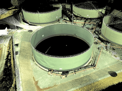
We can apply a variety of surveying technologies to provide topographical survey of green field sites prior to development of a new terminal. This includes aerial lidar, aerial photogrammetry (including using low cost UAV technology), and conventional ground based survey.
For shore based terminals we can add seabed survey using bathymetric and hydrographic methods, plus highly detailed survey of existing berths and jetties using laser scanning methods.
For expansion of existing terminals we can add laser scanning and 3D modelling for pipeline tie-ins to existing plant.
Maintenance of existing plant is enhanced by accessing asset management data via a 3D model of the site. We can generate P&IDs and re-engineer as-built CAD drawings where records of design plans have been lost.
During development of the UK’s latest container terminal ( London Gateway ) we surveyed the river Thames inter-tidal zone for DP World, using aerial Lidar and satellite imagery, so they could comply with their Environmental obligations to ensure there were no detrimental affects during the deep channel dredging.